Geolocate

Henrico topographic map

Click on the map to display elevation.

About this map

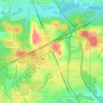
Name: Henrico topographic map, elevation, terrain.

Location: Henrico, DeKalb County, Georgia, 30288, United States (33.64483 -84.35909 33.68483 -84.31909)

Average elevation: 883 ft

Minimum elevation: 758 ft

Maximum elevation: 1,043 ft

DeKalb County trails, hiking, mountain biking, running and outdoor activities

Gear up for your next adventure:

🌐World Map Poster - Decorative world maps with topographic info
🩳Quick‑Dry Hiking Shorts - Comfortable and quick‑dry shorts for summer hiking
🔭Stargazing Telescopes - Perfect for camping in low-light pollution areas shown on maps
Camping Coffee Makers - Enjoy premium coffee at the summit or campsite
🌲Outdoor Survival Books - Best books on survival skills

As an Amazon Associate, this site earns from qualifying purchases at no extra cost to you.