Geolocate

Caputatan Sur topographic map

Click on the map to display elevation.

About this map

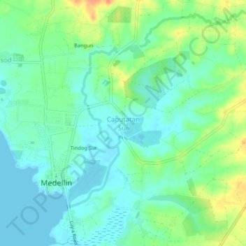
Name: Caputatan Sur topographic map, elevation, terrain.

Location: Caputatan Sur, Cebu, Central Visayas, 6012, Philippines (11.11728 123.95324 11.15728 123.99324)

Average elevation: 46 ft

Minimum elevation: 0 ft

Maximum elevation: 138 ft

Gear up for your next adventure:

🥘Titanium Cookware - Durable, featherlight pots and pans for backpacking
🏥Hiking First Aid Kits - Comprehensive medical kits for remote trail injuries
🛶Inflatable Kayak - Portable kayak for rivers, lakes, and expeditions
🪵Folding Camp Saw - Compact saw for wood and campsite work
🦟Ultrasonic Repellers - Create a bug-free zone at your camp or rest stop

As an Amazon Associate, this site earns from qualifying purchases at no extra cost to you.