
Yakima topographic map
Click on the map to display elevation.
About this map
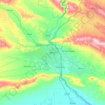
Name: Yakima topographic map, elevation, terrain.
Location: Yakima, Yakima County, Washington, 98901, United States (46.44156 -120.67084 46.76156 -120.35084)
Average elevation: 1,532 ft
Minimum elevation: 807 ft
Maximum elevation: 3,248 ft
Yakima County trails, hiking, mountain biking, running and outdoor activities