Geolocate

Saint Pierre topographic map

Click on the map to display elevation.

About this map

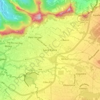
Name: Saint Pierre topographic map, elevation, terrain.

Location: Saint Pierre, St. Pierre VCA, Moka, 81407, Mauritius (-20.26490 57.49838 -20.18490 57.57838)

Average elevation: 1,312 ft

Minimum elevation: 220 ft

Maximum elevation: 2,493 ft

Gear up for your next adventure:

😴Insulated Sleeping Pads - Compact and warm pads for high-elevation camping
🚪Portable Camp Chair - Foldable chair for comfort at camp
🛏️Cold Weather Sleeping Bag - Warm sleeping bag for cold conditions
🌡️Handheld Weather Meters - Measure wind, temp, and pressure for safe mountain travel
🪶Camp Gear Gift Set - Perfect gift bundle for outdoor fans

As an Amazon Associate, this site earns from qualifying purchases at no extra cost to you.