Geolocate

Milton topographic map

Click on the map to display elevation.

About this map

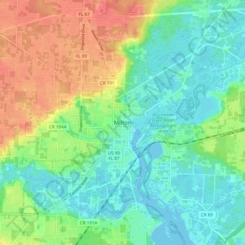
Name: Milton topographic map, elevation, terrain.

Location: Milton, Santa Rosa County, Florida, 32572, United States (30.59241 -87.07969 30.67241 -86.99969)

Average elevation: 69 ft

Minimum elevation: -10 ft

Maximum elevation: 190 ft

Santa Rosa County trails, hiking, mountain biking, running and outdoor activities

Gear up for your next adventure:

🎁Geography Themed Gifts - Unique gift ideas for map lovers and geography enthusiasts
❄️Traction Cleats - Prevent slips on icy trails during winter hikes
Camping Coffee Makers - Enjoy premium coffee at the summit or campsite
🎒Day Hiking Backpack - Lightweight backpack perfect for day trips and outdoor adventures
🌡️Portable Weather Meter - Track weather conditions on the trail

As an Amazon Associate, this site earns from qualifying purchases at no extra cost to you.