Geolocate

Over Alderley topographic map

Click on the map to display elevation.

About this map

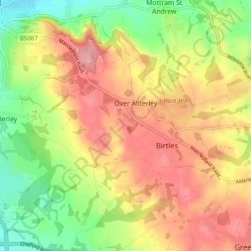
Name: Over Alderley topographic map, elevation, terrain.

Location: Over Alderley, Cheshire East, England, United Kingdom (53.26282 -2.22959 53.30446 -2.16617)

Average elevation: 466 ft

Minimum elevation: 266 ft

Maximum elevation: 643 ft

Gear up for your next adventure:

❄️Traction Cleats - Prevent slips on icy trails during winter hikes
GPS Sports Watch - GPS watch for running, hiking and training
🧯Portable Fire Pit - Compact fire pit for camping spots
🎒Day Hiking Backpack - Lightweight backpack perfect for day trips and outdoor adventures
🌄Hiking Binoculars - Compact binoculars for scenic views and trail spotting

As an Amazon Associate, this site earns from qualifying purchases at no extra cost to you.