Geolocate

Purnia topographic map

Click on the map to display elevation.

About this map

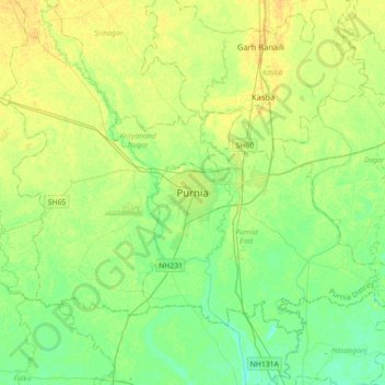
Name: Purnia topographic map, elevation, terrain.

Location: Purnia, Purnia East, Purnia district, Bihar, 854301, India (25.61736 87.31312 25.93736 87.63312)

Average elevation: 125 ft

Minimum elevation: 95 ft

Maximum elevation: 157 ft

Gear up for your next adventure:

🪑Portable Camp Table - Compact table for campsite meals
🚑Emergency Bivvies - Heat-reflective sleeping bags for survival situations
🚗GPS Dash Cams - Record your scenic drives through mountain passes and canyons
🧤Tactile Hiking Gloves - Keep hands warm while operating GPS and smartphone screens
🔭Compact Binoculars - HD vision for scouting terrain and identifying distant landmarks

As an Amazon Associate, this site earns from qualifying purchases at no extra cost to you.