Geolocate

Avon topographic map

Click on the map to display elevation.

About this map

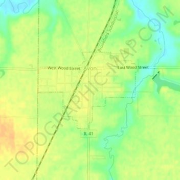
Name: Avon topographic map, elevation, terrain.

Location: Avon, Fulton County, Illinois, United States (40.65518 -90.44508 40.66668 -90.42538)

Average elevation: 633 ft

Minimum elevation: 574 ft

Maximum elevation: 676 ft

Fulton County trails, hiking, mountain biking, running and outdoor activities

Other topographic maps

Click on a map to view its topography, its elevation and its terrain.

Babylon

United States > Illinois > Fulton County

Average elevation: 584 ft

Gear up for your next adventure:

Backpacking Tent - Lightweight and durable tent for multi‑day hikes
🪶Survival Guide Book - Expert advice for emergency preparedness
🪶Compact Camp Shovel - Folding shovel for campsite tasks
🔌USB Car Charger - Car charger for on‑the‑go power needs
⛑️Personal Locator Beacon - Safety beacon for emergencies

As an Amazon Associate, this site earns from qualifying purchases at no extra cost to you.