
Thank you for supporting this site ❤️
Make a donation
Make a donation
Gear up for your next adventure:
As an Amazon Associate, this site earns from qualifying purchases at no extra cost to you.
Tingés topographic map
Click on the map to display elevation.
Thank you for supporting this site ❤️
Make a donation
Make a donation
Gear up for your next adventure:
As an Amazon Associate, this site earns from qualifying purchases at no extra cost to you.
About this map
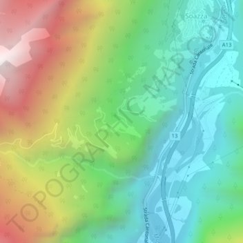
Name: Tingés topographic map, elevation, terrain.
Location: Tingés, Soazza, Moësa, Grisons, 6562, Switzerland (46.34438 9.19966 46.36438 9.21966)
Average elevation: 3,425 ft
Minimum elevation: 1,542 ft
Maximum elevation: 6,890 ft
Thank you for supporting this site ❤️
Make a donation
Make a donation
Gear up for your next adventure:
As an Amazon Associate, this site earns from qualifying purchases at no extra cost to you.