
Glenrock topographic map
Interactive map
Click on the map to display elevation.
About this map
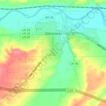
Name: Glenrock topographic map, elevation, terrain.
Location: Glenrock, Converse County, Wyoming, 82637, United States (42.83762 -105.89152 42.86838 -105.82955)
Average elevation: 5,072 ft
Minimum elevation: 4,948 ft
Maximum elevation: 5,279 ft