Geolocate

White Branch topographic map

Click on the map to display elevation.

About this map

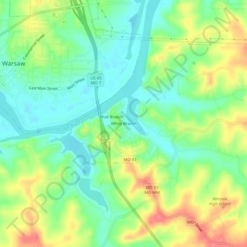
Name: White Branch topographic map, elevation, terrain.

Location: White Branch, Benton County, Missouri, 65355, United States (38.21447 -93.37465 38.25447 -93.33465)

Average elevation: 738 ft

Minimum elevation: 646 ft

Maximum elevation: 879 ft

Benton County trails, hiking, mountain biking, running and outdoor activities

Other topographic maps

Click on a map to view its topography, its elevation and its terrain.

Lincoln

United States > Missouri > Benton County

Average elevation: 935 ft

Ionia

United States > Missouri > Benton County

Average elevation: 961 ft

Gear up for your next adventure:

🔊Portable Camp Speaker - Music and alerts at camp
🧥Waterproof Jacket for Hiking - Breathable and rugged rain jacket for outdoor excursions
🛡️Insect Repellent - Protection against bugs during outdoor activities
📦Gear Storage Bags - Organize and protect outdoor equipment
📱Solar Portable Charger - Solar power bank for charging devices off‑grid

As an Amazon Associate, this site earns from qualifying purchases at no extra cost to you.