
Thank you for supporting this site ❤️
Make a donation
Make a donation
Gear up for your next adventure:
As an Amazon Associate, this site earns from qualifying purchases at no extra cost to you.
Fassinoro topographic map
Click on the map to display elevation.
Thank you for supporting this site ❤️
Make a donation
Make a donation
Gear up for your next adventure:
As an Amazon Associate, this site earns from qualifying purchases at no extra cost to you.
About this map
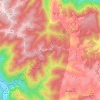
Name: Fassinoro topographic map, elevation, terrain.
Location: Fassinoro, Longone Sabino, Rieti, Lazio, Italia (42.31156 12.91190 42.35156 12.95190)
Average elevation: 2,316 ft
Minimum elevation: 1,335 ft
Maximum elevation: 2,730 ft
Thank you for supporting this site ❤️
Make a donation
Make a donation
Gear up for your next adventure:
As an Amazon Associate, this site earns from qualifying purchases at no extra cost to you.