
Thank you for supporting this site ❤️
Make a donation
Make a donation
Gear up for your next adventure:
As an Amazon Associate, this site earns from qualifying purchases at no extra cost to you.
Feuchtwangen topographic map
Click on the map to display elevation.
Thank you for supporting this site ❤️
Make a donation
Make a donation
Gear up for your next adventure:
As an Amazon Associate, this site earns from qualifying purchases at no extra cost to you.
About this map
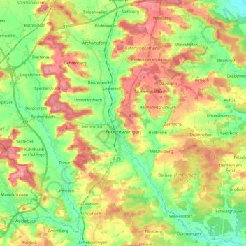
Name: Feuchtwangen topographic map, elevation, terrain.
Location: Feuchtwangen, Ansbach (district), Bavaria, 91555, Germany (49.10706 10.22949 49.23827 10.44162)
Average elevation: 1,558 ft
Minimum elevation: 1,398 ft
Maximum elevation: 1,755 ft
Thank you for supporting this site ❤️
Make a donation
Make a donation
Gear up for your next adventure:
As an Amazon Associate, this site earns from qualifying purchases at no extra cost to you.
Other topographic maps
Click on a map to view its topography, its elevation and its terrain.