
Thank you for supporting this site ❤️
Make a donation
Make a donation
Gear up for your next adventure:
As an Amazon Associate, this site earns from qualifying purchases at no extra cost to you.
Yiqen topographic map
Click on the map to display elevation.
Thank you for supporting this site ❤️
Make a donation
Make a donation
Gear up for your next adventure:
As an Amazon Associate, this site earns from qualifying purchases at no extra cost to you.
About this map
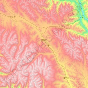
Name: Yiqen topographic map, elevation, terrain.
Location: Yiqen, Pasho County, Chamdo City, Tibet, China (30.27820 96.87910 30.84216 97.44393)
Average elevation: 15,518 ft
Minimum elevation: 10,177 ft
Maximum elevation: 18,865 ft
Thank you for supporting this site ❤️
Make a donation
Make a donation
Gear up for your next adventure:
As an Amazon Associate, this site earns from qualifying purchases at no extra cost to you.