Geolocate

Pine Ridge Country Club Estates topographic map

Click on the map to display elevation.

About this map

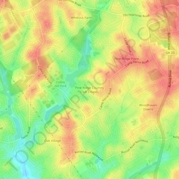
Name: Pine Ridge Country Club Estates topographic map, elevation, terrain.

Location: Pine Ridge Country Club Estates, Lawrenceville, Gwinnett County, Georgia, 30043, United States (33.99760 -84.02796 34.03760 -83.98796)

Average elevation: 1,060 ft

Minimum elevation: 935 ft

Maximum elevation: 1,155 ft

Gear up for your next adventure:

🔦LED Headlamp - Bright and durable LED headlamp for night navigation
🎒Gear Packing Cubes - Organize your backpack efficiently
🥾Women's Hiking Boots - Top-rated trail boots with ankle support and superior grip
🧤Hiking Gloves - Protective gloves for rugged trails
🗃️Trail First Aid Kit - Essential kit for outdoor injuries and emergencies

As an Amazon Associate, this site earns from qualifying purchases at no extra cost to you.