
Thank you for supporting this site ❤️
Make a donation
Make a donation
Gear up for your next adventure:
As an Amazon Associate, this site earns from qualifying purchases at no extra cost to you.
Monte Cucco topographic map
Click on the map to display elevation.
Thank you for supporting this site ❤️
Make a donation
Make a donation
Gear up for your next adventure:
As an Amazon Associate, this site earns from qualifying purchases at no extra cost to you.
About this map
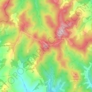
Name: Monte Cucco topographic map, elevation, terrain.
Location: Monte Cucco, Città di Castello, Perugia, Umbria, Italia (43.50238 12.41572 43.50248 12.41582)
Average elevation: 2,306 ft
Minimum elevation: 1,850 ft
Maximum elevation: 2,759 ft
Thank you for supporting this site ❤️
Make a donation
Make a donation
Gear up for your next adventure:
As an Amazon Associate, this site earns from qualifying purchases at no extra cost to you.