Geolocate

Dalig topographic map

Click on the map to display elevation.

About this map

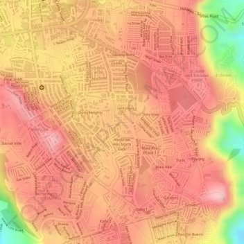
Name: Dalig topographic map, elevation, terrain.

Location: Dalig, Antipolo, Rizal, Calabarzon, 1870, Philippines (14.55967 121.17578 14.58129 121.20411)

Average elevation: 679 ft

Minimum elevation: 262 ft

Maximum elevation: 830 ft

Other topographic maps

Click on a map to view its topography, its elevation and its terrain.

Boso-boso River

Philippines > Rizal > Antipolo > San Joseph

Average elevation: 846 ft

Boso-boso River

Philippines > Rizal > Antipolo

Average elevation: 755 ft

Gear up for your next adventure:

🎒Trail Energy Bars - High‑calorie bars for hiking energy
🪶Trail Camera - Capture wildlife on your hikes
🔦Compact Flashlight - Reliable flashlight for emergencies
🛡️Insect Repellent - Protection against bugs during outdoor activities
Backpacking Tent - Lightweight and durable tent for multi‑day hikes

As an Amazon Associate, this site earns from qualifying purchases at no extra cost to you.