
Thank you for supporting this site ❤️
Make a donation
Make a donation
Gear up for your next adventure:
As an Amazon Associate, this site earns from qualifying purchases at no extra cost to you.
Borghetto topographic map
Click on the map to display elevation.
Thank you for supporting this site ❤️
Make a donation
Make a donation
Gear up for your next adventure:
As an Amazon Associate, this site earns from qualifying purchases at no extra cost to you.
About this map
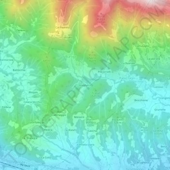
Name: Borghetto topographic map, elevation, terrain.
Location: Borghetto, Burligo, Palazzago, Bergamo, Lombardy, 24030, Italy (45.73042 9.50090 45.77042 9.54090)
Average elevation: 1,713 ft
Minimum elevation: 912 ft
Maximum elevation: 3,957 ft
Thank you for supporting this site ❤️
Make a donation
Make a donation
Gear up for your next adventure:
As an Amazon Associate, this site earns from qualifying purchases at no extra cost to you.