
Thank you for supporting this site ❤️
Make a donation
Make a donation
Gear up for your next adventure:
As an Amazon Associate, this site earns from qualifying purchases at no extra cost to you.
Jatisrono topographic map
Click on the map to display elevation.
Thank you for supporting this site ❤️
Make a donation
Make a donation
Gear up for your next adventure:
As an Amazon Associate, this site earns from qualifying purchases at no extra cost to you.
About this map
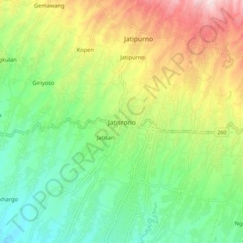
Name: Jatisrono topographic map, elevation, terrain.
Location: Jatisrono, Wonogiri, Central Java, Java, 57691, Indonesia (-7.86629 111.08896 -7.78629 111.16896)
Average elevation: 1,355 ft
Minimum elevation: 794 ft
Maximum elevation: 2,287 ft
Thank you for supporting this site ❤️
Make a donation
Make a donation
Gear up for your next adventure:
As an Amazon Associate, this site earns from qualifying purchases at no extra cost to you.