
Malacca topographic map
Click on the map to display elevation.
Malacca
The state of Malacca covers an area of 1,664 km2 (642 sq mi). It sits upon the southwestern coast of the Malay Peninsula opposite Sumatra, with the state of Negeri Sembilan to the north and west and Johor to the east. Malacca is situated roughly two-thirds of the way down the west coast, 148 km (92 mi) south of Kuala Lumpur and commands a central position on the Straits of Malacca. With the exception of some of its small hills, Malacca is generally a lowland area with average elevation below 50 meters above sea level.
About this map
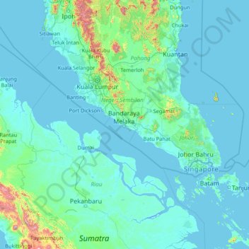
Name: Malacca topographic map, elevation, terrain.
Location: Malacca, Malaysia (-0.33549 99.70147 4.78451 104.82147)
Average elevation: 269 ft
Minimum elevation: -13 ft
Maximum elevation: 8,809 ft