
Make a donation
Gear up for your next adventure:
As an Amazon Associate, this site earns from qualifying purchases at no extra cost to you.
Soiernspitze topographic map
Click on the map to display elevation.
Make a donation
Gear up for your next adventure:
As an Amazon Associate, this site earns from qualifying purchases at no extra cost to you.
About this map
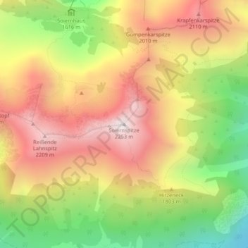
Name: Soiernspitze topographic map, elevation, terrain.
Average elevation: 5,719 ft
Minimum elevation: 3,789 ft
Maximum elevation: 7,385 ft
Make a donation
Gear up for your next adventure:
As an Amazon Associate, this site earns from qualifying purchases at no extra cost to you.
Other topographic maps
Click on a map to view its topography, its elevation and its terrain.
Ferchensee
Deutschland > Bayern > Landkreis Garmisch-Partenkirchen > Mittenwald
Average elevation: 4,206 ft
Soierngruppe
Deutschland > Bayern > Landkreis Garmisch-Partenkirchen > Mittenwald
Im Kessel befindet sich auf einer Höhe von 1616 m ü. NHN das Obere Soiernhaus des Deutschen Alpenvereins (DAV). Die Soiernhäuser wurden ursprünglich von König Ludwig II. errichtet. Bei den Soiernseen (1558 m ü. NHN bzw. 1549 m ü. NHN) liegt das ehemalige Diener- und Wirtschaftsgebäude, das heute von…
Average elevation: 4,134 ft