
Thank you for supporting this site ❤️
Make a donation
Make a donation
Gear up for your next adventure:
As an Amazon Associate, this site earns from qualifying purchases at no extra cost to you.
Deutenbach topographic map
Click on the map to display elevation.
Thank you for supporting this site ❤️
Make a donation
Make a donation
Gear up for your next adventure:
As an Amazon Associate, this site earns from qualifying purchases at no extra cost to you.
About this map
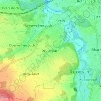
Name: Deutenbach topographic map, elevation, terrain.
Location: Deutenbach, Stein, Fürth (district), Bavaria, 90547, Germany (49.38215 10.98682 49.42215 11.02682)
Average elevation: 1,070 ft
Minimum elevation: 955 ft
Maximum elevation: 1,273 ft
Thank you for supporting this site ❤️
Make a donation
Make a donation
Gear up for your next adventure:
As an Amazon Associate, this site earns from qualifying purchases at no extra cost to you.