Geolocate

Alzey topographic map

Click on the map to display elevation.

About this map
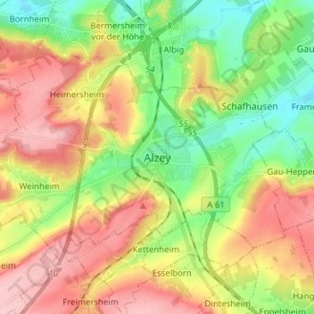
Name: Alzey topographic map, elevation, terrain.

Location: Alzey, Landkreis Alzey-Worms, Rhineland-Palatinate, Germany (49.71895 8.04044 49.77237 8.16632)

Average elevation: 732 ft

Minimum elevation: 489 ft

Maximum elevation: 1,007 ft

Gear up for your next adventure:

📶Satellite Messenger - Communication device off‑grid
🌧️Backpack Rain Cover - Keep gear dry in wet weather
🥩Freeze-Dried Meals - Nutritious and lightweight food for remote expeditions
🧯Portable Fire Pit - Compact fire pit for camping spots
🕶️GPS Smartphone Mount - Secure mount for phone navigation

As an Amazon Associate, this site earns from qualifying purchases at no extra cost to you.