Geolocate

Oroya topographic map

Click on the map to display elevation.

About this map

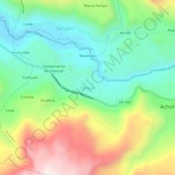
Name: Oroya topographic map, elevation, terrain.

Location: Oroya, Achoma, Caylloma, Arequipa, Peru (-15.67722 -71.73960 -15.63722 -71.69960)

Average elevation: 11,545 ft

Minimum elevation: 10,568 ft

Maximum elevation: 13,225 ft

Gear up for your next adventure:

🎒Hydration Pack - Hands‑free water reservoir for long hikes
🧭Pro Hiking Compasses - High-accuracy liquid-filled compasses for topographic orientation
🔭Stargazing Telescopes - Perfect for camping in low-light pollution areas shown on maps
🛏️Cold Weather Sleeping Bag - Warm sleeping bag for cold conditions
🔌Solar Panel Charger - Charge gear sustainably outdoors

As an Amazon Associate, this site earns from qualifying purchases at no extra cost to you.