Geolocate

Alipang topographic map

Click on the map to display elevation.

About this map

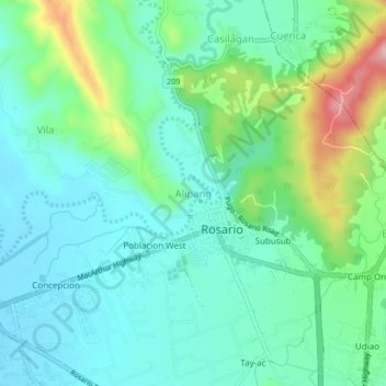
Name: Alipang topographic map, elevation, terrain.

Location: Alipang, Rosario, La Union, Ilocos Region, 2506, Philippines (16.21368 120.46460 16.25368 120.50460)

Average elevation: 492 ft

Minimum elevation: 335 ft

Maximum elevation: 945 ft

Gear up for your next adventure:

📦Gear Storage Bags - Organize and protect outdoor equipment
📡GPS Antenna Upgrade - Enhance GPS reception in remote terrain
🌎3D Topographic Globes - Raised relief globes for a tactile understanding of geography
🛰️Satellite Messengers - Emergency SOS and two-way messaging for off-grid adventures
❄️Traction Cleats - Prevent slips on icy trails during winter hikes

As an Amazon Associate, this site earns from qualifying purchases at no extra cost to you.