
Las Flores topographic map
Click on the map to display elevation.
About this map
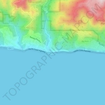
Name: Las Flores topographic map, elevation, terrain.
Average elevation: 331 ft
Minimum elevation: 0 ft
Maximum elevation: 1,690 ft
Los Angeles County trails, hiking, mountain biking, running and outdoor activities
Other topographic maps
Click on a map to view its topography, its elevation and its terrain.
Decker Canyon Camp
United States > California > Los Angeles County > Malibu
Average elevation: 1,263 ft
Topanga County Beach
United States > California > Los Angeles County > Malibu
Average elevation: 174 ft