Geolocate
👉 Easily get elevation data in JSON, GeoTIFF and KML formats using Elevation API
Thank you for supporting this site ❤️
Make a donation

Gunbarrel topographic map

Click on the map to display elevation.

Gunbarrel

Gunbarrel is northeast of the city of Boulder proper, separated by a buffer area of private agricultural lands and publicly owned open space. The buffer areas provide over two miles (3 km) of separation over changing elevations.

Wikipedia (CC-BY-SA 3.0)

About this map

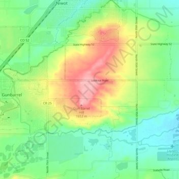
Name: Gunbarrel topographic map, elevation, terrain.

Location: Gunbarrel, Boulder County, Colorado, United States (40.05094 -105.22543 40.08707 -105.13112)

Average elevation: 5,200 ft

Minimum elevation: 5,062 ft

Maximum elevation: 5,427 ft

Boulder County trails, hiking, mountain biking, running and outdoor activities

Gear up for your next adventure:

🧯Portable Fire Pit - Compact fire pit for camping spots
🥾Women's Hiking Boots - Top-rated trail boots with ankle support and superior grip
🥾Hiking Shoes - Durable and comfortable shoes for trail hiking
🪶Camping Sleeping Pad - Comfortable sleeping pad for backpacking
🦟Ultrasonic Repellers - Create a bug-free zone at your camp or rest stop

As an Amazon Associate, this site earns from qualifying purchases at no extra cost to you.