
Immokalee topographic map
Click on the map to display elevation.
About this map
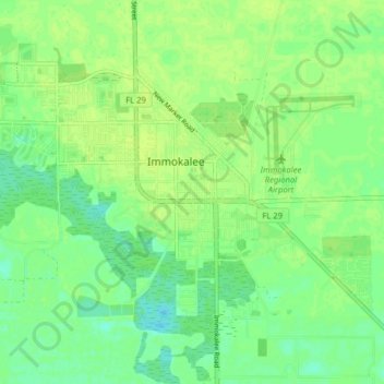
Name: Immokalee topographic map, elevation, terrain.
Location: Immokalee, Collier County, Florida, United States (26.39640 -81.46272 26.44391 -81.38344)
Average elevation: 33 ft
Minimum elevation: 7 ft
Maximum elevation: 49 ft
Collier County trails, hiking, mountain biking, running and outdoor activities
Other topographic maps
Click on a map to view its topography, its elevation and its terrain.
Naples
United States > Florida > Collier County
Naples features a predominantly flat and low-lying topography. The city sits at an elevation of approximately 5 to 10 feet above sea level, contributing to its coastal and marshy characteristics. The terrain is mostly characterized by sandy beaches along the Gulf of Mexico, interspersed with wetlands and…
Average elevation: 10 ft
Marco Island
United States > Florida > Collier County
Marco Island is the largest barrier island within Southwest Florida's Ten Thousand Islands area extending southerly to Cape Sable. Parts of the island have some scenic, high elevations relative to the generally flat south Florida landscape. The island has a tropical climate; specifically a tropical wet and dry…
Average elevation: 7 ft
Marco Island
United States > Florida > Collier County
Parts of the island have some scenic, high elevations relative to the generally flat south Florida landscape. The island has a tropical climate; specifically a tropical wet and dry or savanna type (Aw under the Köppen system). It is known for its distinct wet and dry seasons, with most of the rainfall falling…
Average elevation: 7 ft
Ave Maria
United States > Florida > Collier County > Ave Maria
Ave Maria is 36 miles northeast of downtown Naples, Florida, and part of Collier County. The town's elevation is 18 feet. According to the United States Census Bureau, the city has a total area of 10.42 sq mi (27.0 km2).
Average elevation: 26 ft