Geolocate

Woolwich topographic map

Click on the map to display elevation.

About this map

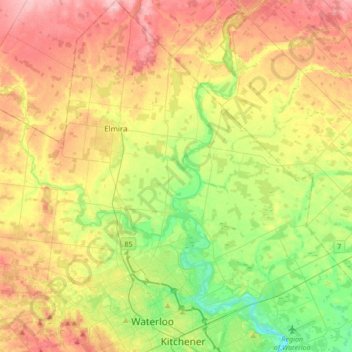
Name: Woolwich topographic map, elevation, terrain.

Location: Woolwich, Region of Waterloo, Ontario, Canada (43.44383 -80.62614 43.68959 -80.30628)

Average elevation: 1,175 ft

Minimum elevation: 948 ft

Maximum elevation: 1,444 ft

Other topographic maps

Click on a map to view its topography, its elevation and its terrain.

Conestogo

Canada > Ontario > Region of Waterloo > Woolwich

Average elevation: 1,076 ft

West Montrose

Canada > Ontario > Region of Waterloo > Woolwich > West Montrose

Average elevation: 1,115 ft

Gear up for your next adventure:

🧭Compass with Lanyard - Easy‑carry compass for navigation
🥩Freeze-Dried Meals - Nutritious and lightweight food for remote expeditions
🧦Merino Wool Socks - Moisture-wicking, blister-preventing socks for long treks
🧴Hand Sanitizer - Keep hands clean while hiking
🛏️Cold Weather Sleeping Bag - Warm sleeping bag for cold conditions

As an Amazon Associate, this site earns from qualifying purchases at no extra cost to you.