
Keerom topographic map
Click on the map to display elevation.
About this map
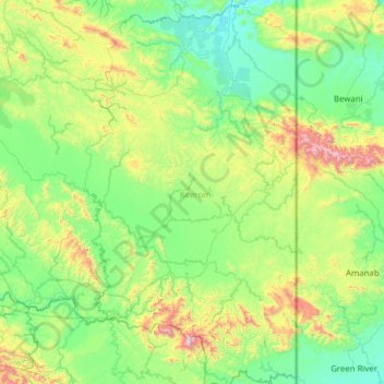
Name: Keerom topographic map, elevation, terrain.
Location: Keerom, Papua, Western New Guinea, Indonesia (-3.95673 140.31358 -2.71060 141.00000)
Average elevation: 1,099 ft
Minimum elevation: 39 ft
Maximum elevation: 5,627 ft
Other topographic maps
Click on a map to view its topography, its elevation and its terrain.