Geolocate

Gößweinstein topographic map

Click on the map to display elevation.

About this map

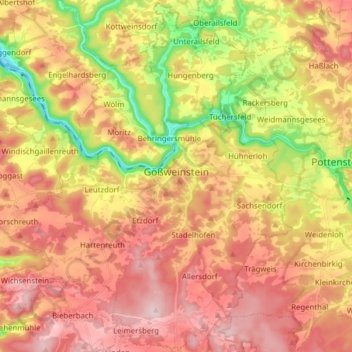
Name: Gößweinstein topographic map, elevation, terrain.

Location: Gößweinstein, Landkreis Forchheim, Bavaria, 91327, Germany (49.71881 11.23286 49.81765 11.38839)

Average elevation: 1,512 ft

Minimum elevation: 1,007 ft

Maximum elevation: 1,896 ft

Other topographic maps

Click on a map to view its topography, its elevation and its terrain.

Guttenburg

Germany > Bavaria > Landkreis Forchheim > Gräfenberg

Average elevation: 1,440 ft

Trainmeusel

Germany > Bavaria > Landkreis Forchheim > Wiesenttal

Average elevation: 1,421 ft

Oberfellendorf

Germany > Bavaria > Landkreis Forchheim > Wiesenttal

Average elevation: 1,385 ft

Gear up for your next adventure:

🪶Multi‑Purpose Knife - Useful blade for camp and trail
🎒Day Hiking Backpack - Lightweight backpack perfect for day trips and outdoor adventures
🧭Hiking Compass - Precision compass for reliable navigation in the wilderness
🗺️Topographic Maps - Detailed topo maps for hiking, exploring and outdoor navigation
📡Handheld GPS Device - Reliable handheld GPS for outdoor navigation

As an Amazon Associate, this site earns from qualifying purchases at no extra cost to you.