Geolocate

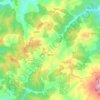
Tafrent topographic map

Click on the map to display elevation.

About this map

Name: Tafrent topographic map, elevation, terrain.

Location: Tafrent, Bathia, Bathia District, Aïn Defla, 44041, Algeria (35.92904 1.79484 35.96904 1.83484)

Average elevation: 3,153 ft

Minimum elevation: 2,156 ft

Maximum elevation: 3,934 ft

Other topographic maps

Click on a map to view its topography, its elevation and its terrain.

El Hassania

Algeria > Aïn Defla > Bathia District

Average elevation: 2,493 ft

Belaas

Algeria > Aïn Defla > Bathia District

Average elevation: 2,152 ft

El Hassania

Algeria > Aïn Defla > Bathia District

Average elevation: 2,493 ft

Bathia

Algeria > Aïn Defla > Bathia District > Bathia

Average elevation: 2,943 ft

Gear up for your next adventure:

🌡️Portable Weather Meter - Track weather conditions on the trail
⌚Solar GPS Watches - Advanced multisport watches with built-in topographic maps
🏔️Mountain Trail Maps - High‑detail maps for popular peaks
🪵Folding Camp Saw - Compact saw for wood and campsite work
☀️Outdoor Sunscreen - High protection sunscreen for outdoor activities

As an Amazon Associate, this site earns from qualifying purchases at no extra cost to you.