
Thank you for supporting this site ❤️
Make a donation
Make a donation
Gear up for your next adventure:
As an Amazon Associate, this site earns from qualifying purchases at no extra cost to you.
Paizás topographic map
Click on the map to display elevation.
Thank you for supporting this site ❤️
Make a donation
Make a donation
Gear up for your next adventure:
As an Amazon Associate, this site earns from qualifying purchases at no extra cost to you.
About this map
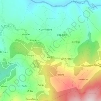
Name: Paizás topographic map, elevation, terrain.
Location: Paizás, Ramirás, Tierra de Celanova, Orense, Galicia, España (42.16466 -8.02285 42.19409 -7.99112)
Average elevation: 1,414 ft
Minimum elevation: 965 ft
Maximum elevation: 2,247 ft
Thank you for supporting this site ❤️
Make a donation
Make a donation
Gear up for your next adventure:
As an Amazon Associate, this site earns from qualifying purchases at no extra cost to you.