
Smallwood topographic map
Click on the map to display elevation.
About this map
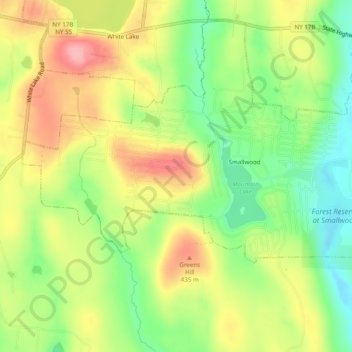
Name: Smallwood topographic map, elevation, terrain.
Average elevation: 1,266 ft
Minimum elevation: 1,089 ft
Maximum elevation: 1,480 ft
Sullivan County trails, hiking, mountain biking, running and outdoor activities
Other topographic maps
Click on a map to view its topography, its elevation and its terrain.
Hurd Settlement
United States > New York > Sullivan County > Town of Bethel
Average elevation: 1,342 ft