
Thank you for supporting this site ❤️
Make a donation
Make a donation
Gear up for your next adventure:
As an Amazon Associate, this site earns from qualifying purchases at no extra cost to you.
Hekou topographic map
Click on the map to display elevation.
Thank you for supporting this site ❤️
Make a donation
Make a donation
Gear up for your next adventure:
As an Amazon Associate, this site earns from qualifying purchases at no extra cost to you.
About this map
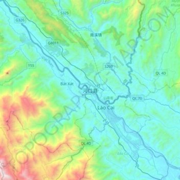
Name: Hekou topographic map, elevation, terrain.
Location: Hekou, Hekou Yao Autonomous County, Yunnan, 661300, China (22.37008 103.77543 22.69008 104.09543)
Average elevation: 1,706 ft
Minimum elevation: 210 ft
Maximum elevation: 8,707 ft
Thank you for supporting this site ❤️
Make a donation
Make a donation
Gear up for your next adventure:
As an Amazon Associate, this site earns from qualifying purchases at no extra cost to you.