Geolocate

Barutuan topographic map

Click on the map to display elevation.

About this map

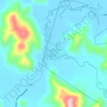
Name: Barutuan topographic map, elevation, terrain.

Location: Barutuan, Palawan, Mimaropa, Philippines (11.28453 119.43039 11.32453 119.47039)

Average elevation: 157 ft

Minimum elevation: -3 ft

Maximum elevation: 961 ft

Gear up for your next adventure:

🧭Hiking Compass - Precision compass for reliable navigation in the wilderness
🥾Men's Hiking Boots - Durable, waterproof footwear for rugged terrain and steep inclines
Backpacking Tents - Weight-optimized shelters for multi-day topographic surveys
🛡️Bear Spray Outdoor - Protection in bear country hikes
🍳Camping Cook Set - Complete cookware for outdoor meals

As an Amazon Associate, this site earns from qualifying purchases at no extra cost to you.