
Thank you for supporting this site ❤️
Make a donation
Make a donation
Gear up for your next adventure:
As an Amazon Associate, this site earns from qualifying purchases at no extra cost to you.
Meylan topographic map
Click on the map to display elevation.
Thank you for supporting this site ❤️
Make a donation
Make a donation
Gear up for your next adventure:
As an Amazon Associate, this site earns from qualifying purchases at no extra cost to you.
About this map
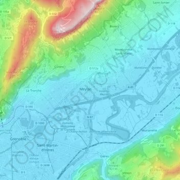
Name: Meylan topographic map, elevation, terrain.
Location: Meylan, Auvergne-Rhône-Alpes, Metropolitan France, 38240, France (45.16925 5.74120 45.24925 5.82120)
Average elevation: 1,329 ft
Minimum elevation: 682 ft
Maximum elevation: 4,423 ft
Thank you for supporting this site ❤️
Make a donation
Make a donation
Gear up for your next adventure:
As an Amazon Associate, this site earns from qualifying purchases at no extra cost to you.