Geolocate

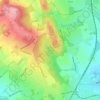
Wythall CP topographic map

Click on the map to display elevation.

About this map

Name: Wythall CP topographic map, elevation, terrain.

Location: Wythall CP, Hollywood, Bromsgrove, Worcestershire, England, United Kingdom (52.35891 -1.93464 52.40745 -1.84548)

Average elevation: 509 ft

Minimum elevation: 417 ft

Maximum elevation: 656 ft

Other topographic maps

Click on a map to view its topography, its elevation and its terrain.
Stoke Prior

United Kingdom > England > Worcestershire > Bromsgrove

Average elevation: 223 ft

Clent Hills

United Kingdom > England > Worcestershire > Bromsgrove > Clent

Average elevation: 689 ft

Hollywood

United Kingdom > England > Worcestershire > Bromsgrove

Average elevation: 515 ft

Rowney Green

United Kingdom > England > Worcestershire > Bromsgrove

Average elevation: 410 ft

Gear up for your next adventure:

🥘Titanium Cookware - Durable, featherlight pots and pans for backpacking
🧣Hiking Neck Gaiter - Multi‑use neck protection for outdoor weather
🔊Portable Camp Speaker - Music and alerts at camp
🏕️Tent Footprint - Protect your tent base from wear
🧢Outdoor Hiking Hat - Sun protection hat for outdoor explorers

As an Amazon Associate, this site earns from qualifying purchases at no extra cost to you.