
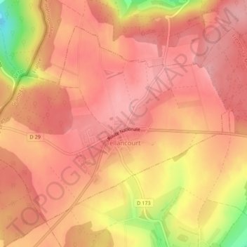
Tellancourt topographic map
Interactive map
Click on the map to display elevation.
About this map
Name: Tellancourt topographic map, elevation, terrain.
Average elevation: 1,230 ft
Minimum elevation: 942 ft
Maximum elevation: 1,329 ft
Other topographic maps
Click on a map to view its topography, its elevation and its terrain.
Les Noires Colas
Frankreich > Großer Osten > Mörthe und Mosel > Bionville > Les Noires Colas
Average elevation: 1,545 ft