Geolocate

Tasi topographic map

Click on the map to display elevation.

About this map

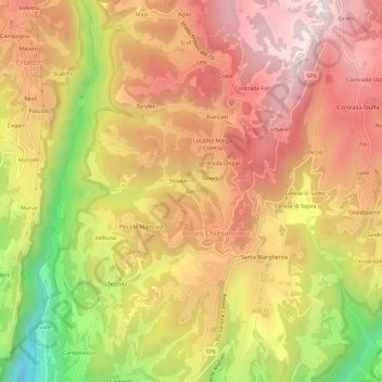
Name: Tasi topographic map, elevation, terrain.

Location: Tasi, Bosco Chiesanuova, Verona, Veneto, 37021, Italy (45.60646 11.00577 45.64646 11.04577)

Average elevation: 3,356 ft

Minimum elevation: 1,798 ft

Maximum elevation: 4,390 ft

Gear up for your next adventure:

🧥Waterproof Jacket for Hiking - Breathable and rugged rain jacket for outdoor excursions
🥤Water Filter Bottle - All‑in‑one filter bottle for safe hydration
📦Dry Bags Set - Waterproof storage for electronics and clothes
🌡️Portable Weather Meter - Track weather conditions on the trail
🎒Outdoor Daypacks - Lightweight backpacks designed for carrying maps and essential gear

As an Amazon Associate, this site earns from qualifying purchases at no extra cost to you.