
Thank you for supporting this site ❤️
Make a donation
Make a donation
Gear up for your next adventure:
As an Amazon Associate, this site earns from qualifying purchases at no extra cost to you.
Enekullen topographic map
Click on the map to display elevation.
Thank you for supporting this site ❤️
Make a donation
Make a donation
Gear up for your next adventure:
As an Amazon Associate, this site earns from qualifying purchases at no extra cost to you.
About this map
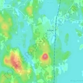
Name: Enekullen topographic map, elevation, terrain.
Location: Enekullen, Rörvik, Sävsjö kommun, 570 01, Sweden (57.21187 14.55088 57.25187 14.59088)
Average elevation: 719 ft
Minimum elevation: 656 ft
Maximum elevation: 942 ft
Thank you for supporting this site ❤️
Make a donation
Make a donation
Gear up for your next adventure:
As an Amazon Associate, this site earns from qualifying purchases at no extra cost to you.