Geolocate

Lanao topographic map

Click on the map to display elevation.

About this map

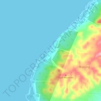
Name: Lanao topographic map, elevation, terrain.

Location: Lanao, Pilar, Cebu, Central Visayas, Philippines (10.74234 124.48395 10.78234 124.52395)

Average elevation: 115 ft

Minimum elevation: -7 ft

Maximum elevation: 548 ft

Gear up for your next adventure:

🖼️Topo Map Wall Art - Decorative topographic prints of famous peaks and regions
🗺️NatGeo Topo Maps - High-quality waterproof printed topographic maps of US Parks
🦶Carbon Trekking Poles - Reduce knee impact on steep descents with ultra-light poles
📦Gear Storage Bags - Organize and protect outdoor equipment
📖Nature Tracking Books - Learn to track wildlife and terrain

As an Amazon Associate, this site earns from qualifying purchases at no extra cost to you.