
Thank you for supporting this site ❤️
Make a donation
Make a donation
Gear up for your next adventure:
As an Amazon Associate, this site earns from qualifying purchases at no extra cost to you.
Bagna topographic map
Click on the map to display elevation.
Thank you for supporting this site ❤️
Make a donation
Make a donation
Gear up for your next adventure:
As an Amazon Associate, this site earns from qualifying purchases at no extra cost to you.
About this map
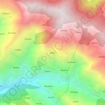
Name: Bagna topographic map, elevation, terrain.
Location: Bagna, Theog, Shimla, Himachal Pradesh, 173223, India (30.99547 77.43743 31.03547 77.47743)
Average elevation: 6,670 ft
Minimum elevation: 4,304 ft
Maximum elevation: 8,812 ft
Thank you for supporting this site ❤️
Make a donation
Make a donation
Gear up for your next adventure:
As an Amazon Associate, this site earns from qualifying purchases at no extra cost to you.