Geolocate

伊勢町 topographic map

Click on the map to display elevation.

About this map

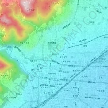
Name: 伊勢町 topographic map, elevation, terrain.

Location: 伊勢町, Nagano, Nagano Prefecture, 380-0851, Japan (36.63850 138.16925 36.67850 138.20925)

Average elevation: 1,444 ft

Minimum elevation: 1,142 ft

Maximum elevation: 2,684 ft

Gear up for your next adventure:

🚪Portable Camp Chair - Foldable chair for comfort at camp
🥾Women's Hiking Boots - Top-rated trail boots with ankle support and superior grip
🗺️NatGeo Topo Maps - High-quality waterproof printed topographic maps of US Parks
🎒Trail Energy Bars - High‑calorie bars for hiking energy
💧Water Purification System - Clean water on the trail with reliable purifiers

As an Amazon Associate, this site earns from qualifying purchases at no extra cost to you.