
Overton topographic map
Click on the map to display elevation.
About this map
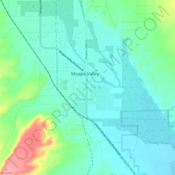
Name: Overton topographic map, elevation, terrain.
Location: Overton, Moapa Valley, Clark County, Nevada, United States (36.52073 -114.46299 36.56073 -114.42299)
Average elevation: 1,325 ft
Minimum elevation: 1,230 ft
Maximum elevation: 1,624 ft
Clark County trails, hiking, mountain biking, running and outdoor activities