Geolocate

Contornina topographic map

Click on the map to display elevation.

About this map

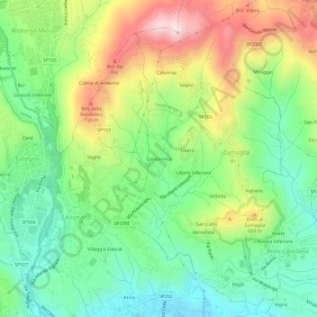
Name: Contornina topographic map, elevation, terrain.

Location: Contornina, Zumaglia, Biella, Piemonte, 13848, Italia (45.57302 8.05546 45.61302 8.09546)

Average elevation: 1,759 ft

Minimum elevation: 1,191 ft

Maximum elevation: 2,690 ft

Gear up for your next adventure:

🔥Camping Stove - Portable stove for camping and backcountry cooking
📡GPS Antenna Upgrade - Enhance GPS reception in remote terrain
🎒Day Hiking Backpack - Lightweight backpack perfect for day trips and outdoor adventures
👖Convertible Hiking Pants - Versatile zip-off pants for changing altitudes and temperatures
🥾Women's Hiking Boots - Top-rated trail boots with ankle support and superior grip

As an Amazon Associate, this site earns from qualifying purchases at no extra cost to you.