Geolocate

Croce topographic map

Click on the map to display elevation.

About this map

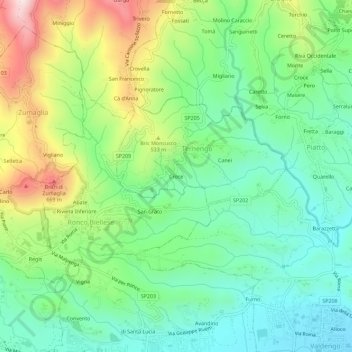
Name: Croce topographic map, elevation, terrain.

Location: Croce, Ternengo, Biella, Piemonte, 13844, Italia (45.56656 8.09264 45.60656 8.13264)

Average elevation: 1,404 ft

Minimum elevation: 892 ft

Maximum elevation: 2,421 ft

Gear up for your next adventure:

🔭Compact Binoculars - HD vision for scouting terrain and identifying distant landmarks
🌄Hiking Binoculars - Compact binoculars for scenic views and trail spotting
🔌Solar Panel Charger - Charge gear sustainably outdoors
Backpacking Tents - Weight-optimized shelters for multi-day topographic surveys
📡Handheld GPS Device - Reliable handheld GPS for outdoor navigation

As an Amazon Associate, this site earns from qualifying purchases at no extra cost to you.