
Thank you for supporting this site ❤️
Make a donation
Make a donation
Gear up for your next adventure:
As an Amazon Associate, this site earns from qualifying purchases at no extra cost to you.
Riaz topographic map
Click on the map to display elevation.
Thank you for supporting this site ❤️
Make a donation
Make a donation
Gear up for your next adventure:
As an Amazon Associate, this site earns from qualifying purchases at no extra cost to you.
About this map
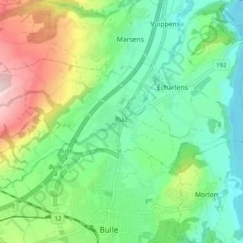
Name: Riaz topographic map, elevation, terrain.
Location: Riaz, Gruyère District, Fribourg, 1632, Switzerland (46.62672 7.01101 46.65309 7.07894)
Average elevation: 2,539 ft
Minimum elevation: 2,182 ft
Maximum elevation: 3,310 ft
Thank you for supporting this site ❤️
Make a donation
Make a donation
Gear up for your next adventure:
As an Amazon Associate, this site earns from qualifying purchases at no extra cost to you.