
Thank you for supporting this site ❤️
Make a donation
Make a donation
Gear up for your next adventure:
As an Amazon Associate, this site earns from qualifying purchases at no extra cost to you.
Singuilucan topographic map
Click on the map to display elevation.
Thank you for supporting this site ❤️
Make a donation
Make a donation
Gear up for your next adventure:
As an Amazon Associate, this site earns from qualifying purchases at no extra cost to you.
About this map
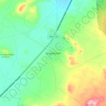
Name: Singuilucan topographic map, elevation, terrain.
Location: Singuilucan, Hidalgo, México (19.92709 -98.55948 20.00709 -98.47948)
Average elevation: 8,734 ft
Minimum elevation: 8,346 ft
Maximum elevation: 9,580 ft
Thank you for supporting this site ❤️
Make a donation
Make a donation
Gear up for your next adventure:
As an Amazon Associate, this site earns from qualifying purchases at no extra cost to you.