
Thank you for supporting this site ❤️
Make a donation
Make a donation
Gear up for your next adventure:
As an Amazon Associate, this site earns from qualifying purchases at no extra cost to you.
L'Achard topographic map
Click on the map to display elevation.
Thank you for supporting this site ❤️
Make a donation
Make a donation
Gear up for your next adventure:
As an Amazon Associate, this site earns from qualifying purchases at no extra cost to you.
About this map
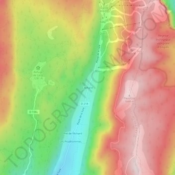
Name: L'Achard topographic map, elevation, terrain.
Average elevation: 4,606 ft
Minimum elevation: 3,583 ft
Maximum elevation: 5,436 ft
Thank you for supporting this site ❤️
Make a donation
Make a donation
Gear up for your next adventure:
As an Amazon Associate, this site earns from qualifying purchases at no extra cost to you.
Other topographic maps
Click on a map to view its topography, its elevation and its terrain.
Falaises du Vercors – Rochers du Cumacle
France > Auvergne-Rhône-Alpes > Isère > Autrans-Méaudre en Vercors > Autrans
Average elevation: 3,727 ft